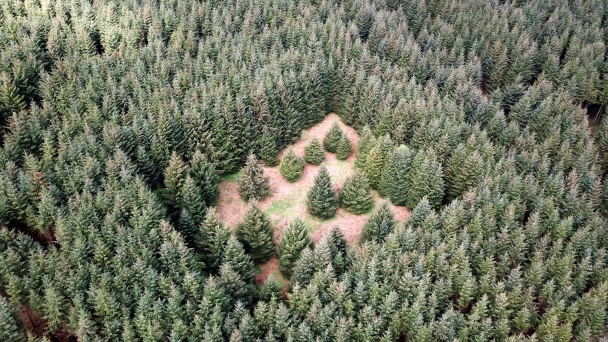
A moated site on the eastern slopes of Brandon Hill, Co Kilkenny
At 515m, Brandon Hill is the highest point in Co. Kilkenny. The mountain is teeming with archaeology and rich in folklore. However, a moated site on the eastern slopes of the mountain, in the townland of Ballyogan and overlooking the River Barrow, has defied explanation. It was described in 1849 as a “quadrangular fort with about half a dozen small stone cells inside”. Today the monument is heavily overgrown and surrounded by forestry, which makes it difficult to decipher. There is limited evidence of features above ground.
The Community Group: Tyndall Mountain Club
Tyndall Mountain Club has been in existence for almost forty years and has about 120 members. Members have contributed over the years to various community projects in association with An Taisce, Kilkenny Leader Partnership, Leave no Trace, Get Ireland Walking, Heritage Week and Ballykeeffe Amphitheatre development.
Tyndall Mountain Club have adopted this enigmatic structure and want to learn more about it through a programme of archaeological investigation and historical research.
Thanks to funding from the Heritage Council and Creative Ireland in 2019 through the Adopt a Monument Scheme, the group commissioned Geoaerospace to undertake a LiDAR survey as a first step to discovering more about the site.
With guidance from the Adopt a Monument team, the group have also being doing archival research to see if they can unearth any documentary evidence about the nature and purpose of the site.

